Disclaimer: This page may contain affiliate links. Please review our full Terms and Conditions for more information and our Privacy Policy. Note that any pricing, operating hours, or other such information provided below may have changed since initial publication.
Compiled by the Road Trip Alberta team
Last Updated on January 16, 2025
It shouldn’t come as a surprise that ALL of the hikes in Banff are breathtaking! Even a walk through the town of Banff will wow you – especially if it’s your first visit. There is an excellent reason why hiking is one of the best things to do in Banff National Park. So if all you want is a great hike, you can close down your browser, throw a dart at a map of Banff National Park, and be confident there’s an incredible hike wherever the tip touches.
However, if you want to find the cream of the crop – the absolute best Banff hikes that will suit your skill level – keep on reading because we’ve got a list of hikes that are guaranteed not only to impress but to match your skill level too.
Know Before You Go
Be Prepared for Weather Conditions
Weather can change drastically and quickly in Banff National Park. So before you go, check the weather forecast and prepare accordingly. Make sure to pack for all sorts of weather (from sun to snow) and bring sunblock, sunglasses, bear spray and a hat. Finally, be sure to let people know where you plan to go in case of an emergency. The more prepared you are, the better.
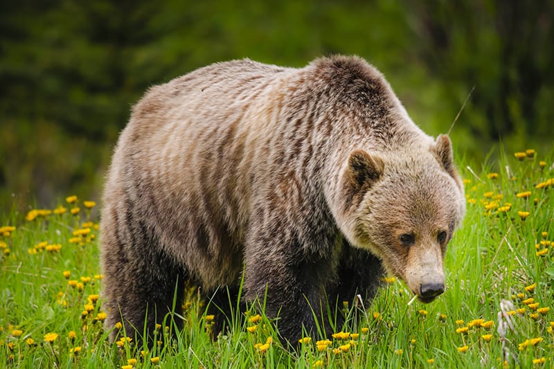
Stay Bear Safe
Before we go any further, it’s essential to mention all these hikes in Banff are located in bear country. Though bear spray isn’t required to bring (although recommended) on the more heavily trafficked trails, you should always be bear aware. That means: make noise while you’re hiking (sing, talk, etc.), don’t throw out food along the trails (apple cores, crumbs, etc.), and if you see a bear, stay calm and keep moving. Don’t try to get closer to it; remember to tell others nearby about your bear sighting.
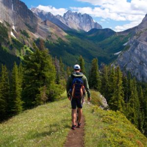
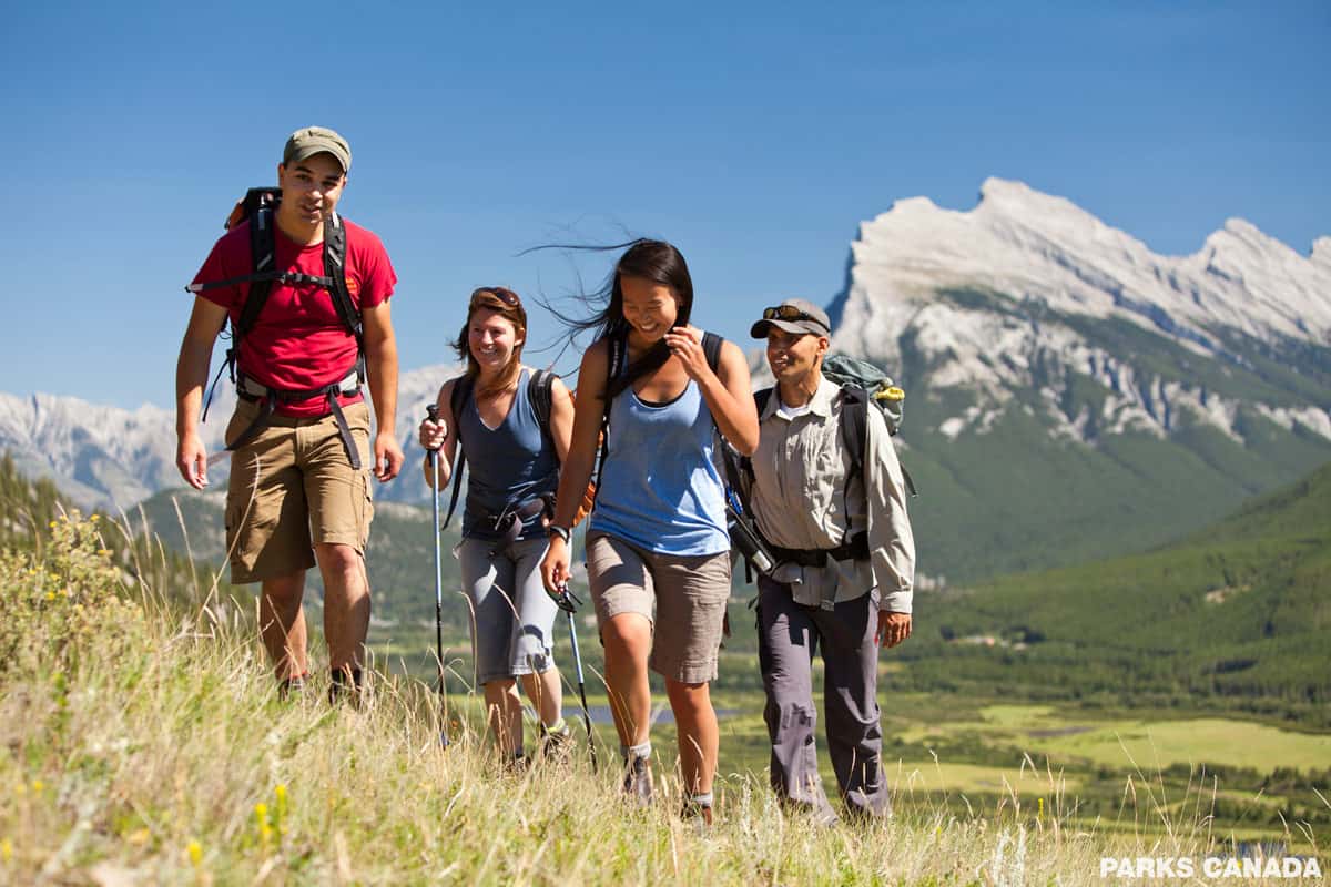
Easy Hikes in Banff National Park
Not everyone likes hiking for days to attain a summit, but in Banff, that’s (literally) no sweat! There are a variety of hikes accessible to everyone, with amazing views, beautiful forests, and enough scenery to fill up your Instagram feed, along with your heart.
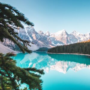
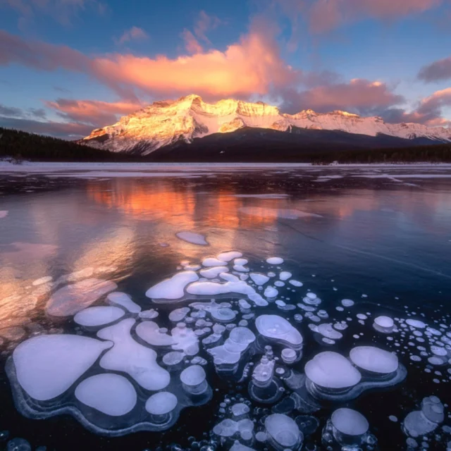
Moraine Lake Rockpile
Moraine Lake is absolutely gorgeous, which is why it’s one of the most trafficked hikes in Banff. Note that the Moraine Lake road is closed to personal vehicles. Unfortunately, this means you have limited options to arrive. We recommend booking a shuttle with the Moraine Lake Bus Company – not only are they the only company to offer sunrise shuttles (gotta get those epic shots for the ‘Gram!), but they are also the only company that lets you pre-book your return journey (so that you don’t have to wait).
Another other option is to cycle to Moraine Lake. It’s a 14 km (one-way) journey with beautiful vistas along the way. There are bicycle racks at the lake to lock your bike up. Parks Canada does not recommend hiking or walking the 14 km to Moraine Lake.
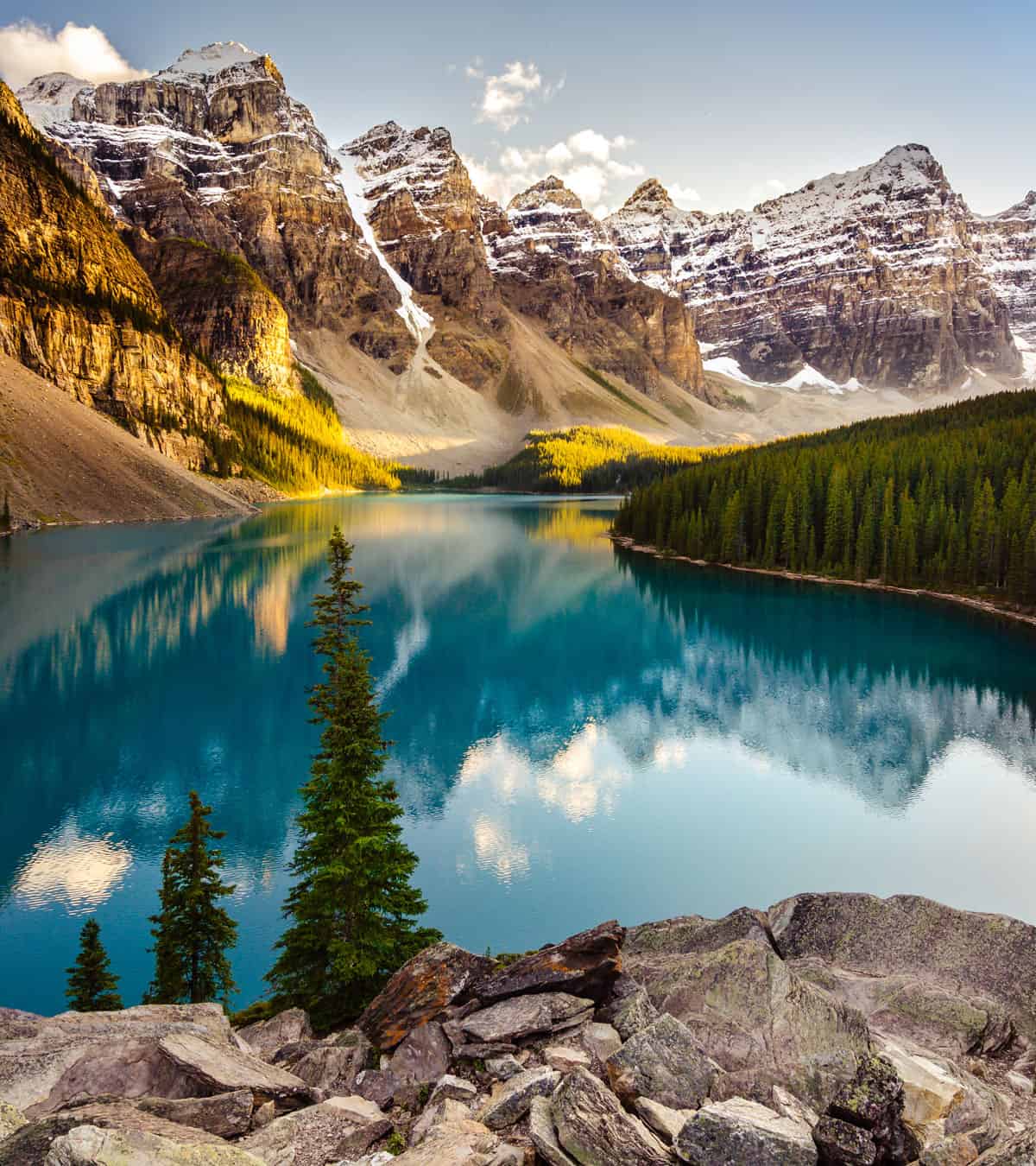
Once you’ve to Moraine Lake, there’s nothing but a short walk to the Instagram-famous Moraine Lake rockpile. This view is undoubtedly one of the most popular spots in the Canadian Rockies. You can head back to the parking lot and hike around the lake if you want more!
Trail Information:
- Difficulty: Easy
- Distance: 0.8 km return
- Elevation gain: 30 m
- Hiking time: 25 minutes round trip (if you don’t get caught up taking pictures for a few hours)
- Trail map: The trailhead leaves right from the Moraine Lake Parking Lot.
- What to bring: A sturdy pair of runners will do fine for this hike, as well as some water or a thermos full of coffee.
- Seasonality: June – October. *note that it is possible to cross-country ski into Moraine Lake in winter, but check for avalanche warnings.
Lake Agnes Teahouse, Little Beehive and Big Beehive
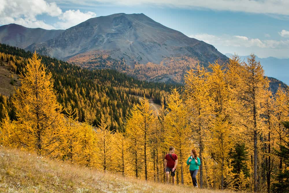
Want to sit down to tea and crumpets (or soup and biscuits) at the top of your hike? Crazy as it sounds, Banff has you covered! The Lake Agnes hike features a series of switchbacks that lead to a beautiful waterfall, and beyond that, the Lake Agnes Tea House is nestled along the shores of the brilliant turquoise blue, glacier-fed Lake Agnes.
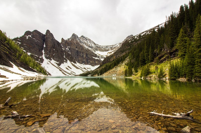
Stop for tea and photos (especially if you’re there during the fall when the larch trees turn a bright and brilliant yellow), then continue up Little Beehive (the trail goes up behind the tea house – ask one of the waitstaff at the tea house if you’re unsure where to go) where at the lookout you can watch canoes skitter across the surface of Lake Louise like water bugs.
Trail Information:
- Difficulty: Easy to Moderate
- Distance: Lake Agnes: 7 km round trip; Little Beehive: an extra 2 km round trip; Big Beehive: an additional 10.5 km round trip.
- Elevation gain: 385 m
- Hiking time: 2.5 to 3 hours round trip
- Trail map: The trailhead leaves right from Lake Louise Chateau. Head out to the right of the lake from the Chateau and follow the signs to Lake Agnes Trail. Keep an eye out, as a wrong turn will send you halfway out to the Plain of Six Glaciers instead (ask us how we know).
- What to bring: A sturdy pair of runners, hiking poles, bear spray, some layers to make sure you’re cool enough, water, lunch and snacks (you can buy lunch at the Tea House – cash only – plan on bringing about $25 – $30 CAD per person).
- Seasonality: The tea house is open June through October, but the trail is open year-round.
*This trail also offers a moderate option if you take the Big Beehive trail to the right of Lake Agnes from the tea house.
Johnston Canyon and Ink Pots
Featuring bridges, forests, waterfalls, and the famous Ink Pots – the only thing that matches the beauty of the Johnston Canyon hike are the crowds that flock to see it. The trail winds through Johnston Canyon and hikers will first arrive at the lower falls and then the upper falls. But, for those a little more adventurous than the average tourist, the trail also proceeds to the Ink Pots, which are small, naturally occurring, light blue mineral springs.
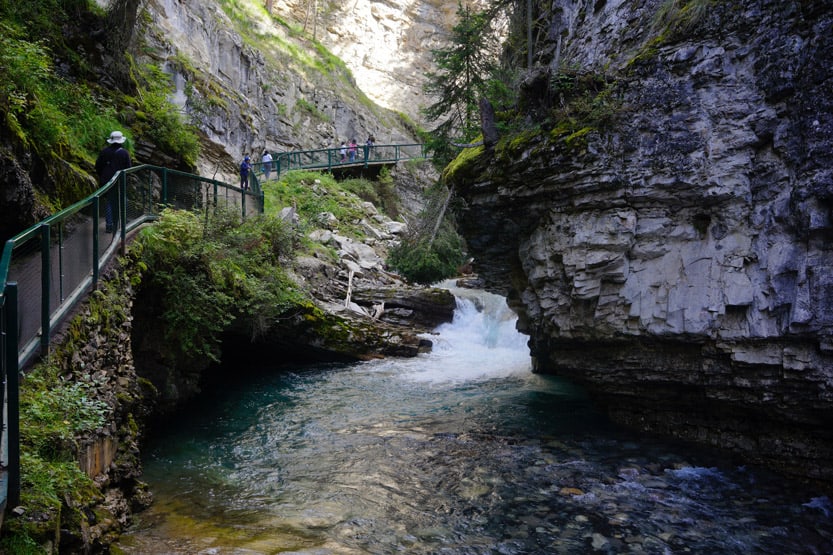
Whether you end your trek at the upper falls or go beyond the Ink Pots, the relaxed pace and accessibility make Johnston Canyon an excellent choice for an easy hike. (It also happens to be on our list of the best Alberta hikes.)
Trail Information:
- Difficulty: Easy to moderate
- Distance: 12 km round trip (to the Ink Pots)
- Elevation gain: 215 metres (700 feet)
- Hiking time: Upper Falls – 1.5 hours return. Ink Pots – 3 – 4 hours return
- Trail map: The trail starts right behind Johnston Canyon Lodge.
- What to bring: A solid pair of running shoes, water and snacks. As with all hikes, weather-appropriate clothing is a must.
- Seasonality: Open year-round, but best from May until October.
Two Jack Lake Trail
Two Jack Lake is less a hike than a ‘choose your own adventure’ series of trails with plenty of options for hikers and those who want to stretch their legs in a gorgeous mountain setting. Take a quick half-hour stroll, or continue along the shores of Two Jack Lake until it meets Lake Minnewanka – the choice is yours.
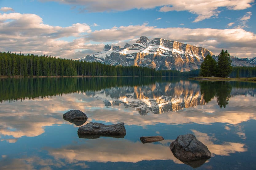
Wherever you end up hiking, you’ll enjoy the peace and tranquillity of the area, along with views of a gorgeous lake. If you fancy a cool-off in the summertime, you could brave a quick jump into the ice-cold waters of Two Jack!
Trail Information:
- Difficulty: Easy
- Distance: 4.7 km
- Hiking time: 2 hours
- Elevation gain: 303 m
- Trail map: Park your car at the rest stop or leave directly from your Two Jack Lakeside campsite.
- What to bring: Sturdy shoes, water, snacks, a camera, and bear spray.
- Seasonality: Open year-round, best from May until October.
Moderate Hikes in Banff National Park
Ready for a bit of a challenge to spice up your visit? These hikes in Banff National Park will make you sweat, but not too much. Most of the below hikes will require around half of your day, and we highly recommend packing a lunch, but every single one of them is worth the investment. If you like to hike but don’t want to spend the whole day sweating or scrambling up rocks to the summit, these moderate hikes are perfect for you!
Minnestima Lakes via Larch Valley Trail
*Note that you will need to reserve a shuttle to Moraine Lake.
If you’ve woken up at 5:00 am to see Moraine Lake but crave a hike with a bit more challenge than the rockpile, Larch Valley is the way to go. The Larch Valley hike begins lakeside, just to the right of the lake as you approach, but quickly ascends. The valley is full of wildflowers in the summer, and in autumn, the larches turn to golden torches. This is definitely the most popular and best time for this hike.
* Due to bears, this hike may require a minimum number of hikers per group, but hikers are often waiting at the bottom to be grouped up.
Trail Information:
- Difficulty: Moderate
- Distance: 8.9 km round trip (out and back)
- Elevation gain: 607 m
- Hiking time: 4 – 5 hrs
- Trail map: Begins at Moraine Lake Lodge. Follow the trail with the lake on your left, then take the path marked Sentinel Pass.
- What to bring: Hiking boots, hiking poles, water, snacks, bear spray, and weather-appropriate clothing.
- Seasonality: June – October – peak season is mid-September (keep your eye on Instagram to see when the larches are turning).
Tunnel Mountain Hike
A quick hike that’s easily accessible, the Tunnel Mountain trail leaves straight from the townsite and is one of the most highly trafficked hikes in Banff. The trail ascends Tunnel Mountain through an evergreen forest before opening up to breathtaking views of Banff and the surrounding nature. So if you’re pressed for time or don’t want to drive all over Banff National Park to find a good hike, this is the hike for you!
Trail Information:
- Difficulty: Moderate
- Distance: 4.5 km round trip
- Elevation gain: 266m
- Hiking time: 2 to 3 hours
- Trail map: The trailhead and parking lot is on St. Julien Road, right next to the Harmon Residence. It’s easily accessible from downtown via car or your own two feet.
- What to bring: Hiking boots, water, snacks, and weather-appropriate clothing.
- Seasonality: Open year-round, but best from May to September.
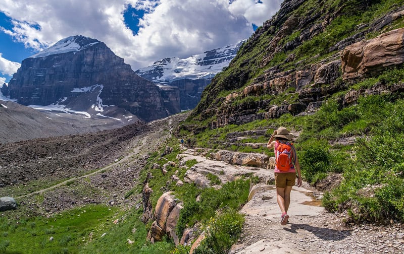
Plain of Six Glaciers
Lake Agnes isn’t the only hike featuring a tea house to warm, chilly travellers. The Plain of Six Glaciers trail leaves from Chateau Lake Louise and hugs the lake before ascending to the plain where the tea house beckons weary travellers. From there, hikers can continue to one of the eponymous glaciers to take in the views, including three mountain peaks (Mt. Whyte, Devil’s Thumb and Fairview Mountain) as well as Lake Louise, where you started your adventure.
Trail Information:
- Difficulty: Moderate
- Distance: 13.8 km round trip
- Elevation gain: 587m
- Hiking time: 5 hours
- Trail map: The trailhead starts at Chateau Lake Louise. Follow the Lake Louise lakeshore trail and follow the signs.
- What to bring: Warm clothing, hiking boots, hiking poles, bear spray, water, snacks and cash (no credit cards) if you want to have tea or crumpets at the tea house.
- Seasonality: June to October.
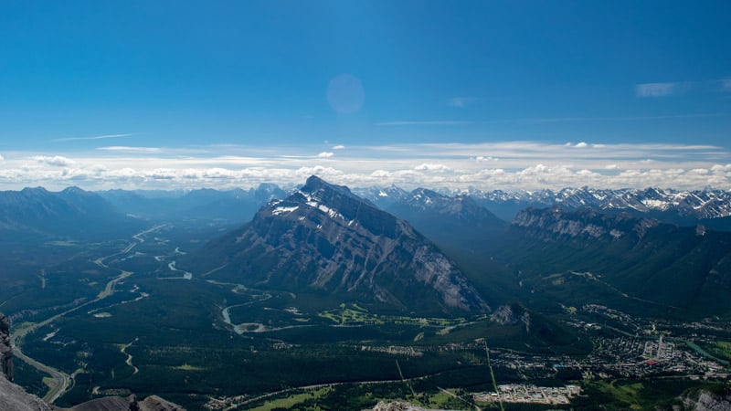
Sulphur Mountain Trail
Want to really get that heart pumping? Sulphur Trail follows a series of strenuous switchbacks through forested terrain to gain elevation quickly and start your quads burning! Of course, you could take the Banff Gondola up, skipping the switchbacks (and if you’re too tired once you get to the top, we definitely recommend that, as weariness can cause accidents on this strenuous hike), but where’s the fun in that?
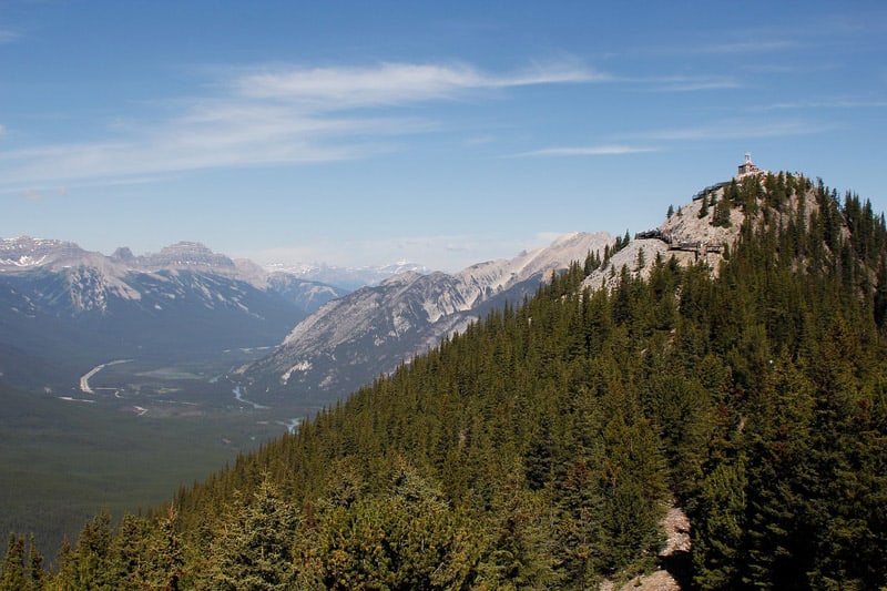
At the summit, there is a wooden boardwalk and viewpoint to admire the beauty of the Bow Valley. And don’t forget to take advantage of the pub on top of the mountain to celebrate your climb with a cold beer.
Trail Information:
- Difficulty: Moderate
- Distance: 10.9 km round trip
- Elevation gain: 756m
- Hiking time: 2.5 – 3 hours
- Trail map: The trailhead starts at the parking lot just off Mountain Ave., near Banff Hot Springs.
- What to bring: Hiking boots, hiking poles, snacks, water, warm clothing, camera.
- Seasonality: Open year-round, but best from May until October.
Parker Ridge Trail
This is one of the trails we ALWAYS recommend to our readers. It’s a short, get-your-blood-pumping hike with stunning views as a reward. Hikers will cross through the forest, by creeks and waterfalls and most likely see wildlife (be sure to bring bear spray!). At the summit are beautiful panoramic views and a lookout of the Saskatchewan Glacier, Saskatchewan River and the stunning Canadian Rockies.
Trail Information:
- Difficulty: Moderate
- Distance: 6.4 km round trip
- Elevation gain: 338m
- Hiking time: 2 – 3 hours
- Trail map: The Parker Ridge trail is located near the Banff National Park boundary right along the Icefields Parkway (Highway 93).
- What to bring: Hiking boots, hiking poles, extra clothes, water, snacks, and a camera.
- Seasonality: Open year-round, but best from May until October.
Peyto Lake Panorama Hike
Looking for a moderate hike in Banff that’s short but sweet? Check out the Peyto Lake Panorama Hike, found off of the Icefields Parkway north of Lake Louise. Only taking about an hour to complete, this loop includes views of Bow Lake, the glacier to the west, Peyto Lake, and the Canadian Rockies, making it perfect for those who are short on time but still want a little hike to take in the scenery.
Once you leave the parking lot, a short paved trail brings you to a wooden viewing deck for views over the lake; this spot is usually extremely busy. From there, you can move on to the second lookout, which is often much quieter.
Trail Information:
- Difficulty: Moderate
- Distance: 2.4 km round trip
- Elevation gain: 93m
- Hiking time: 1 hour
- Trail map: The trailhead is found off of the Icefields Parkway.
- What to bring: Hiking boots, water, snacks, and a camera.
- Seasonality: Open year-round, but best from May until October.
Hard Hikes in Banff National Park
Here they are, the most difficult, scambliest, least populated, best hikes in Banff. Do you dare take on these mountains? If you’ve got the fitness and the experience, each of the below hikes will repay tenfold every ounce of energy you put in. So buckle up for an adventure and take your hiking to the next level!
Helen Lake and Cirque Peak Trails
An hour’s drive north of Banff, past Lake Louise, up the Icefields Parkway, the Cirque Peak Trail features the beautiful Helen Lake and gorgeous views worth the drive. The day hike up to Helen Lake is tiring but not overwhelming. However, if you still have the energy, pushing up to Cirque Peak through scree and scramble is worth it. At the summit are views of the turquoise Bow lake and Bow Glacier in the distance.
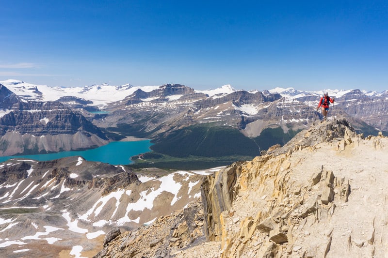
Be careful on the ascent and descent, as the scramble can be challenging and may even require that you ditch your poles meters from the top to free up your hands for an all-points finale.
Trail Information:
- Difficulty: Moderate to hard
- Distance: 16.1 km
- Elevation gain: 1,131m
- Hiking time: 6 – 8 hrs
- Trailhead: Located just off the Icefields parkway next to Bow Lake, the trailhead parking lot is right across from a highway rest area.
- What to bring: Good hiking boots, layered clothing, plenty of water and snacks, and hiking poles (highly recommended).
- Seasonality: Open year-round, but best from June to October.
Sentinel Pass
If you can tear yourself away from the beauty of Moraine Lake and the blazing tamarack trees of Larch Valley, you’ll discover Sentinel Pass and why this is one of the best hikes in Banff National Park and the Canadian Rockies. Once past the larches, the hiking trail opens into a beautiful alpine meadow with three lakes, then follows switchbacks, often covered with snow well into summer, to attain Sentinel Pass.
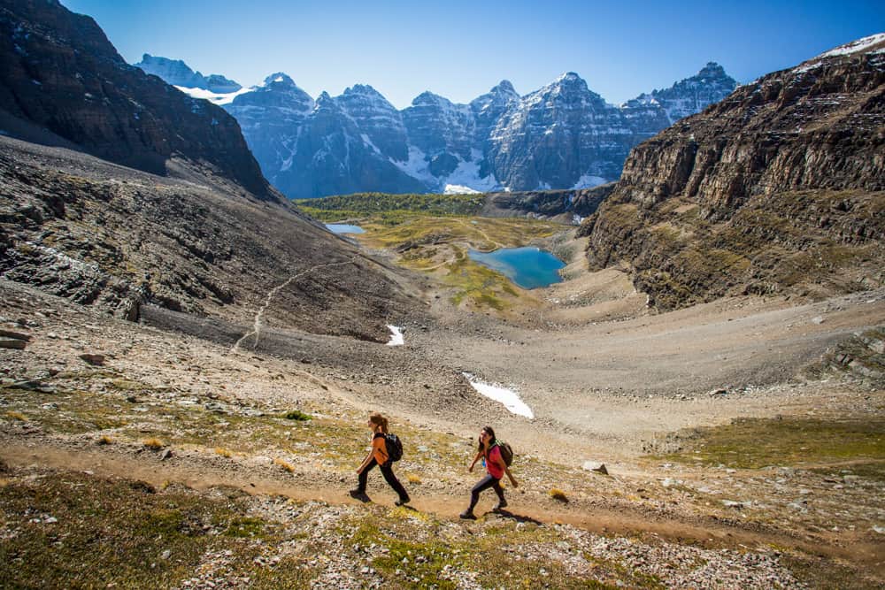
The hike winds through the most picturesque terrains in the park to the craggy views. Sentinel Pass is impossible to beat and is one of the best hikes in Banff National Park.
*Due to bears, this hike may require a minimum number of hikers per group, but hikers are often waiting at the bottom to be grouped up.
Trail Information:
- Difficulty: Hard
- Distance: 11.1 km round trip
- Elevation gain: 799m
- Hiking time: 4-6 hrs
- Trail map: The trail begins at Moraine Lake Lodge. Follow the path with the lake on your left, then take the route marked Sentinel Pass. Note that personal vehicles are no longer allowed on Moraine Lake road. A shuttle must be reserved to access the lake.
- What to Bring: Hiking boots, hiking poles, water, bear spray, snacks, layered clothing, and hiking poles (recommended).
- Seasonality: June to October.
Mount Rundle
Not for the faint of heart, the Mount Rundle Trail is steep and long and features some scrambling to attain the summit. But, if summiting a mountain in Banff is on your to-do list, it’s hard to find a better hike. The trail starts in the forest, but once you hit the switchbacks, it quickly climbs past the treeline to an alpine ridge.
Follow the ridge up past two false summits, and you’ll find the real summit where you can enjoy a well-deserved rest along with the unreal landscape views.
Trail Information:
- Difficulty: Hard
- Distance: 15.1 km round trip
- Elevation gain: 1,738m
- Hiking time: 9+ hrs
- Trail map: The trailhead is just out of town on River Ave., just after the bridge across Spray River.
- What to bring: Hiking boots, poles, bear spray, plenty of water and snacks, and layered clothing.
- Seasonality: Open year-round but best from June to September.
Cory Pass Circuit
Technically two trails, Edith Pass and Cory Pass, meet just behind Mt. Edith to form a loop. However, we suggest taking a clockwise approach up Cory Pass first, as you’ll have fresher legs for the more dangerous and strenuous parts of the hike.
Cory Pass features scrambles, steep inclines and narrow trails over very steep drops that offer amazing views but may cause a touch of vertigo in anyone who struggles with heights. However, once you attain the top, after taking in the views, you can look forward to a much milder decline courtesy of Edith Pass.
Trail Information:
- Difficulty: Hard
- Distance: 12.7 km loop
- Elevation gain: 1,135m
- Hiking time: 6 – 8 hrs
- Trail map: The Cory Pass trail leaves from a parking lot just off Highway 1, 10 minutes west of Banff
- What to bring: Good hiking boots, bear spray, layered clothing, plenty of water and snacks, and hiking poles are recommended.
- Seasonality: Open year-round but best from May to October.
Need some help planning your itinerary? Check out our guide for all the things to do while visiting Banff National Park. Included are details on how to enjoy the best of nearby Alberta hot springs (which you’ll need after some of these hikes)!
Also, you’ve probably worked up an appetite! Check out our guide to Banff restaurants to discover the best chow in town. Or start your day right with our picks for the best brunch in Banff.
Want more hikes? Here is a post of nearby hikes in Kananaskis, another on hiking in Jasper National Park, and our top picks in Waterton Lakes National Park.
ALSO, don’t forget that while you’re on the road, you can download our FREE Road Trip Alberta bingo cards, to make it just that much more fun!