Disclaimer: This page may contain affiliate links. Please review our full Terms and Conditions for more information and our Privacy Policy. Note that any pricing, operating hours, or other such information provided below may have changed since initial publication.
Compiled by the Road Trip Alberta team
Last updated on January 6, 2025
With plenty of opportunities to trek in mountains, Badlands, thick forests, and wide-open prairie, one thing is certain when you are tackling a variety of Alberta hikes… you will not be bored!
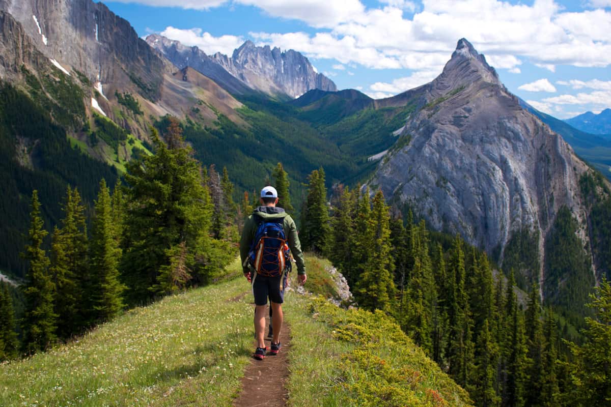
We’ve got many miles under our own hiking boots in order to fill out a proper listicle, but we also asked our expert trekking friends for their top trails. Below you’ll find options found across the province and for all abilities, too. There are hiking trails for everyone!
General Tips for Enjoying Alberta Hikes
- Packing bear spray with you (and knowing how to use it) is important, especially when you’re in the mountains from March through November.
- Encountering other wildlife like mountain goats, deer, and more is entirely possible and likely if you plan on hiking a lot. Be mindful of your interactions – check out our guide on Alberta wildlife so that you know what to expect.
- Always check current conditions before heading out as there are a number of reasons why a trail could close with little notice, including nearby bear activity, trail repairs, avalanches, and more. Seasonal road closures leading to the trailheads may affect some as well.
- If attempting any of these Alberta hikes in spring or winter (note that some are not suitable), we recommend ice cleats or crampons to safely walk on those paths that may be snow or ice-covered.
- Note that you may be required to purchase a park pass depending on where you will be:
Don’t Miss These Amazing Alberta Hikes
Ptarmigan Cirque (Kananaskis)
This tops our list of best hikes in Alberta because it has so much beauty to offer in a short trek. Ptarmigan Cirque starts with a steep incline until the tree line is reached, and then the views open up to the surrounding peaks and valleys of Kananaskis.
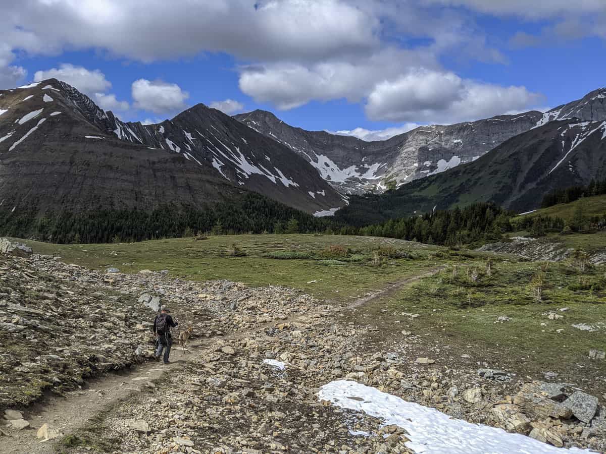
In spring, expect wildflowers to blanket the edges of the trail, but also expect to be greeted by a cold wind at the top. While it is open year-round, the best times to visit are June through September. Given that the scenery is so stunning and varied for such a short hike, this is a popular one. Try going on weekdays to avoid the crowds.
- Distance: 4.5 km
- Elevation gain: 210 m
- Difficulty: Moderate
- Estimated time to complete: 1 hour and 30 minutes
- Trailhead location: At the top of Highwood Pass – the highest public road in Canada – leave your car at the Highwood Meadows Day Use Area parking lot on the west side of Hwy 40. Then follow the Highwood Meadows Interpretive Trail boardwalk to the Ptarmigan Cirque trailhead. Note that the path will take you across the highway.
- Be sure to bring: Layers! It can be cold and windy at the top. Also have water and some light snacks on hand.
Table Mountain (Castle Provincial Park)
Alberta’s newest provincial park is home to several gorgeous hikes on the edge of the Rocky Mountains, but Table Mountain tops the list as a personal favourite in the area. It’s a steep climb most of the way to the summit, but we are sure that you’ll declare it well worth your time and effort when you lay eyes on the stunning scenery that surrounds you.
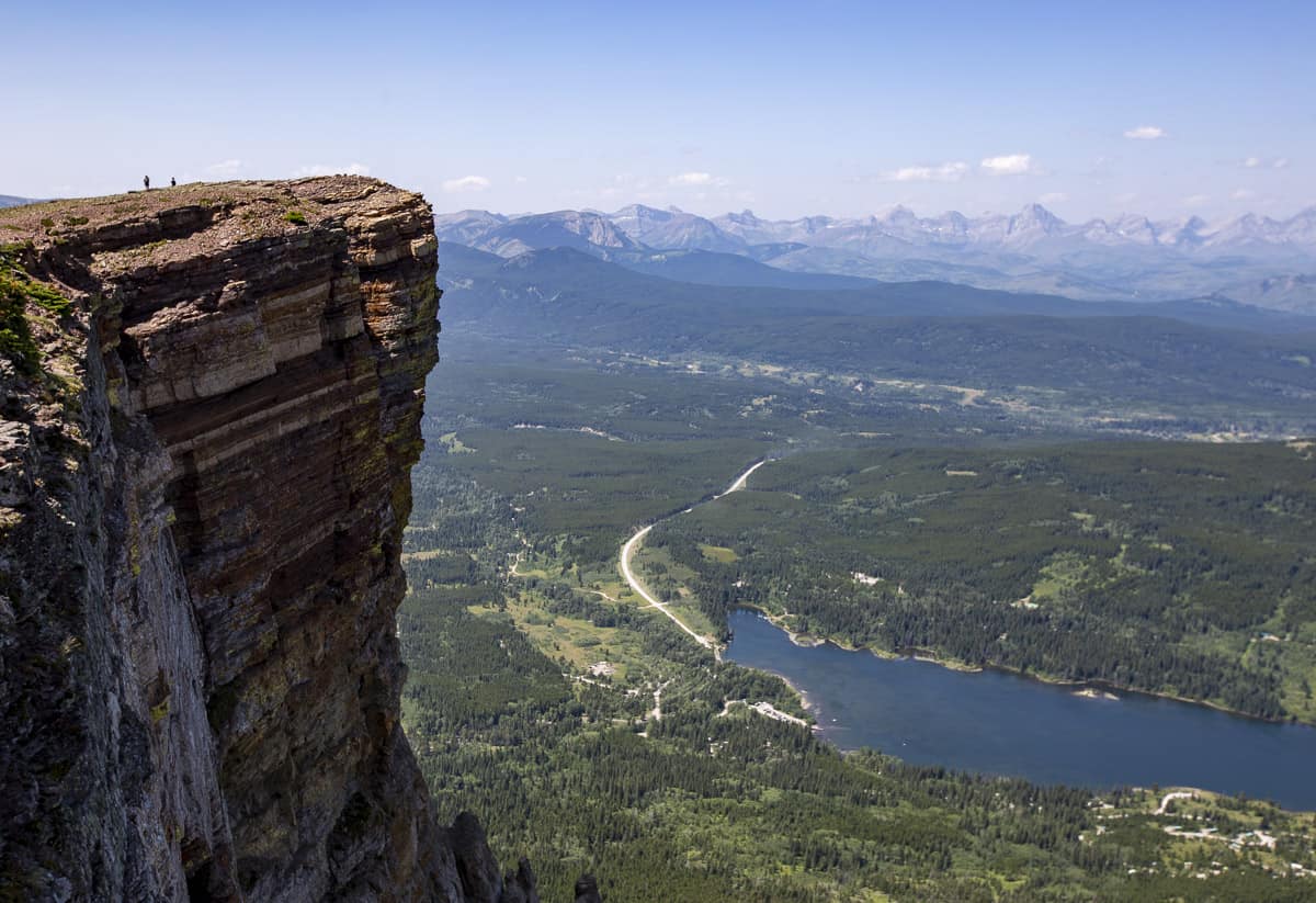
Note that the second half of the trail is largely loose rock and scree, making it tough to get traction in parts. Proper footwear and hiking poles are a must. There are ways to avoid sections of the tough stuff – at one point, you can take a long switchback versus going straight up on very loose terrain. But overall, this is one of several Alberta hikes where you need to be sure to step carefully.
Like most hikes in the Canadian Rockies, expect a chill wind at the top. And while this is a popular trail, it is less so than others in the mountains of Alberta, so you will be able to still enjoy some blissful serenity as well.
- Distance: 10 km
- Elevation gain: 832 m
- Difficulty: Hard
- Estimated time to complete: 4 hours, 20 minutes
- Trailhead location: Enter the Beaver Mines Lake Campground and continue straight for about half a kilometre. There will be signage and the trail begins as the road begins to bend left.
- Be sure to bring: Hiking poles, footwear with ankle supports, water, snacks, and layers of clothing.
Crypt Lake Trail (Waterton Lakes National Park)
Many publications (including National Geographic) rate the Crypt Lake hike as one of the most thrilling and best hiking trails in the entire world. It is a beautiful hike – without a doubt – but in our humble opinion, it is a lot of effort for the reward in comparison to other trails in the Alberta Rockies.
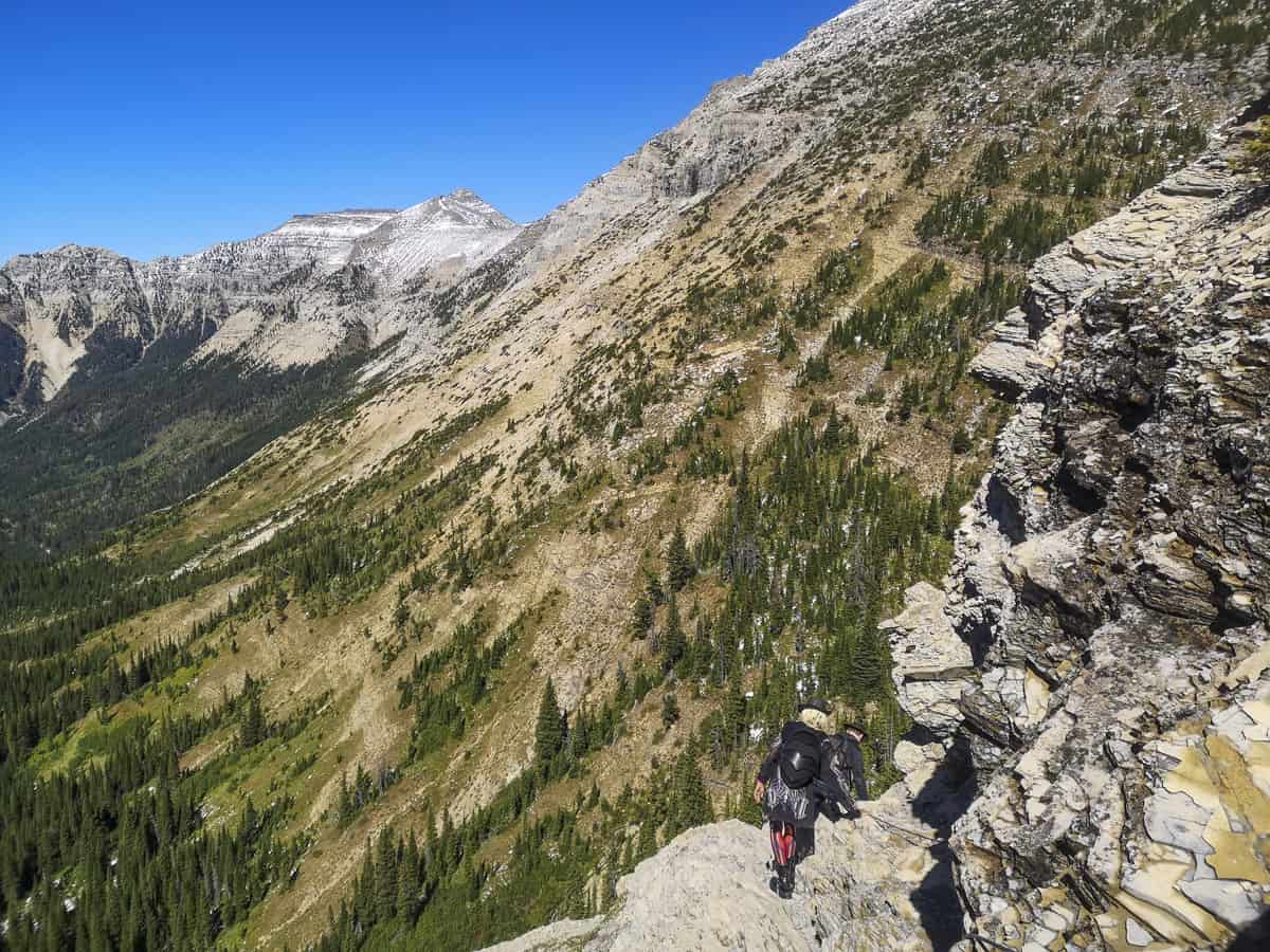
Near the end of the trail – when you walk along a small mountain ledge leading to a natural tunnel – you’ll find that it certainly offers something you won’t find elsewhere, but a significant chunk of the hike on the way there offers relatively less remarkable scenery.
However! If testing your nerve and pushing your stamina on a long trek is your ultimate desire, then we’re sure you’ll enjoy this top-rated Alberta hike.
- Distance: 17.5 km
- Elevation gain: 675 m
- Difficulty: Hard
- Estimated time to complete: 6 hours
- Trailhead location: A 15-minute boat ride via Waterton Shoreline Cruise Co. across Upper Waterton Lake will bring you to the trailhead at Crypt Lake Landing. You can also access the trailhead by hiking/biking 14 km of the Wishbone Trail, but this will make your day a very long one. Note that the boat typically runs only from early/mid-June to early October.
- Be sure to bring: Hiking poles are recommended. Also bring snacks and plenty of water – this is a long hike and you need to be prepared.
Johnston Canyon (Banff National Park)
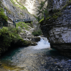
Johnston Canyon is one of the most beloved attractions in Alberta’s national parks, and rightfully so. Not only for the sheer beauty seen along the trail – think lush forest, overhanging canyon walls, waterfalls, brilliant aquamarine water – but also because the first part of the walk to the Lower Falls is mostly a smooth and flat trail, making it accessible for many.
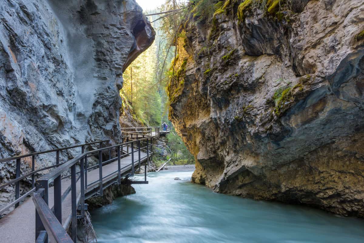
Getting to the Upper Falls is a little steeper, and beyond that, you can also reach the famed Ink Pots. The further you go, the more solitude you’ll find on this popular route. This is a can’t-miss trail in the Rockies – try to arrive early in the morning or get there on a weekday instead in order to try and beat the relentless crowds.
- Distance: Lower Falls is 1.2 km one-way, Upper Falls is 2.5 km, and Ink Pots is 5.7 km.
- Elevation gain: 50 m for Lower Falls, 120 m for Upper Falls, and 330 m for Ink Pots.
- Difficulty: Lower and Upper Falls are easy, while Ink Pots is a moderately difficult hike.
- Estimated time to complete: 1 hour for Lower Falls, 2 hours for Upper Falls, and 4 hours for Ink Pots.
- Trailhead location: 30 minutes from Banff, this trail can be accessed from the Johnston Canyon parking lot, just off of the Bow Valley Parkway.
- Be sure to bring: Waterproof jacket, snacks, and water.
Horseshoe Canyon (near Drumheller)
If you want to change up your scenery from mountain peaks, head east. Just 15 minutes southwest of Drumheller, Horseshoe Canyon is probably your first stop if you’re coming in from Calgary. Perched on the edge of a glacier-carved valley, Horseshoe Canyon is aptly named, because the canyon itself has been formed into the shape of a ‘U’.
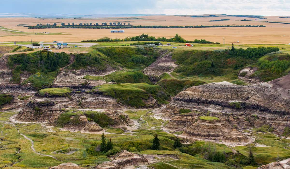
After you’ve marvelled at the jaw-dropping lookout point near the parking lot, hike the short loop down into the canyon and meander along the bottom. Enjoy the serenity of this lightly trafficked trek in a stunning and historic area where dinosaurs and cowboys once roamed (but not at the same time) :).
- Distance: 4 km
- Elevation gain: 120 m
- Difficulty: Moderate
- Estimated time to complete: 1 hour and 20 minutes
- Trailhead location: The Horseshoe Canyon parking lot and picnic area just off Township Road 284.
- Be sure to bring: Hat and sunscreen (there is minimal shade) lots of water, snacks, and light clothing for a summer hike.
Valley of the Five Lakes (Jasper National Park)
Here’s the thing about hiking in Jasper National Park: it’s impossible to choose a bad hike! But the Valley of the Five Lakes is one of the most exceptional Alberta hikes because it takes you to (you guessed it) FIVE brilliant mountain lakes, each with their own shades of blue-green.
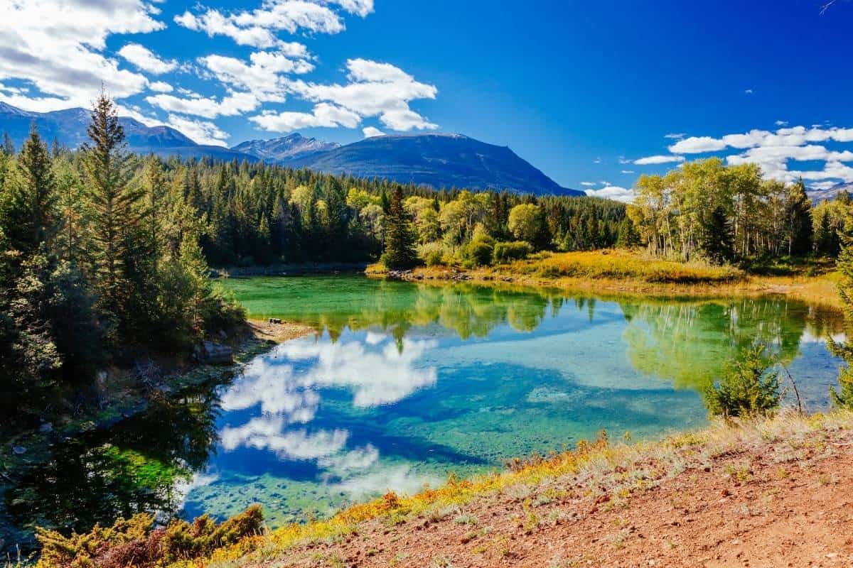
What makes it most remarkable is that you get all of those stunning lake views, plus that of an alpine meadow, in a short distance without a tremendous amount of effort.
- Distance: 4.7 km
- Elevation gain: 66 m
- Difficulty: Easy
- Estimated time to complete: 2 hours
- Trailhead location: Along the Icefields Parkway, 9 km south on Highway 93
- Be sure to bring: Several layers of clothes (it can be cool), snacks, and water. Feeling brave? Bring a swimsuit too and dare to enter the crispy cold water!
Siffleur Falls (David Thompson Country)
This amazing hike to Siffleur Falls is a family favourite through flat grasslands and forests. There are some gorgeous viewpoints along the way with guardrails, plus two suspension bridges and a scenic boardwalk through a fragile area. The distance below is to the first falls – there are two more beyond that which will almost double the hike length.
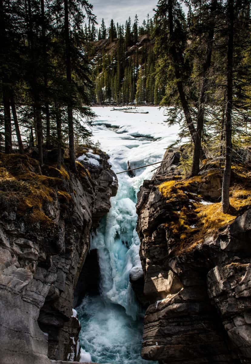
Even though much of David Thompson Country is still considered a “hidden gem” by Alberta tourism standards, this is still a pretty popular hike. Be prepared for it to be crowded in summer.
- Distance: 8 km
- Elevation gain: 80 m
- Difficulty: Easy
- Estimated time to complete: 4 hours, 20 minutes
- Trailhead location: Approximately 62 km west of Nordegg on Highway 11 and 21 km east of the Banff National Park boundary. The trail starts at the Siffleur Falls Staging Area near the south end of Abraham Lake.
- Be sure to bring: Several layers of clothing, water, and snacks.
Turtle Mountain (Crowsnest Pass)
Turtle Mountain is the most popular trail in the area (as one of the top things to do in Crowsnest Pass) and is considered a challenging trek. Not only because it is largely a steep hike, but is also quite rocky near the top and even requires some decent skills at finding the route (it’s not well marked).
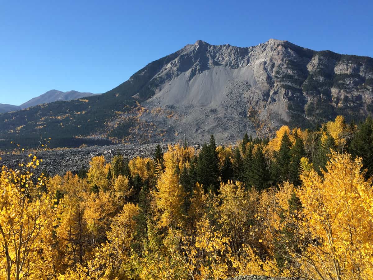
There are two summits – the north peak (a false summit) is fairly easy for experienced hikers, but expect some scrambling beyond that to the south peak. The stunning views of the Rocky Mountains, along with the pride of accomplishing this challenge, will make it all worth it.
- Distance: 7.4 km
- Elevation gain: 936 m
- Difficulty: Hard
- Estimated time to complete: 4 hours
- Trailhead location: A back alley off 15th Avenue in Blairmore will lead down to a parking area below the trail.
- Be sure to bring: Hiking poles, proper hiking boots with ankle support, a windbreaker, a rain jacket, water, several layers of clothing, and snacks.
Big Beehive (Lake Louise / Banff National Park)
There are a number of great trail options starting at Lake Louise, and in all honesty, you really can’t go wrong with any of them. But the Big Beehive trail is popular for a very good reason – it’s a fun challenge for experienced hikers and the views from the “Big Beehive” are tremendous.
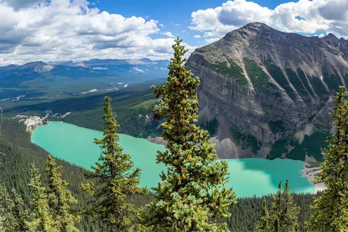
It starts with an easy stroll along the brilliant Lake Louise itself before a gentle climb to Lake Agnes (plan for a stop at the Tea House for a unique experience). From Lake Agnes, the trail gets a bit more strenuous, but beautiful views of Lake Louise from above are available along the way, making it all worthwhile. Take a rest under the pergola at the end of Big Beehive before turning around and making the trek back.
- Distance: 10.9 km
- Elevation gain: 776 m
- Difficulty: Moderate to Difficult
- Estimated time to complete: 4 hours, 30 minutes
- Trailhead location: In front of Chateau Lake Louise, along the lakeshore.
- Be sure to bring: Hiking poles, bear spray, rain gear, several layers of clothing, snacks, and water.
Bear’s Hump (Waterton Lakes National Park)
Of all the Alberta hikes, this one gives you the best bang for your buck (or, views for your effort), hands down. It’s a short trek straight up Mount Crandell on a well-groomed trail (completely upgraded since the 2017 Kenow fire) to a spectacular viewpoint over the townsite below. Even though it is a bit of a steep hike, it’s accessible to most given the short length and some spots to rest along the way.
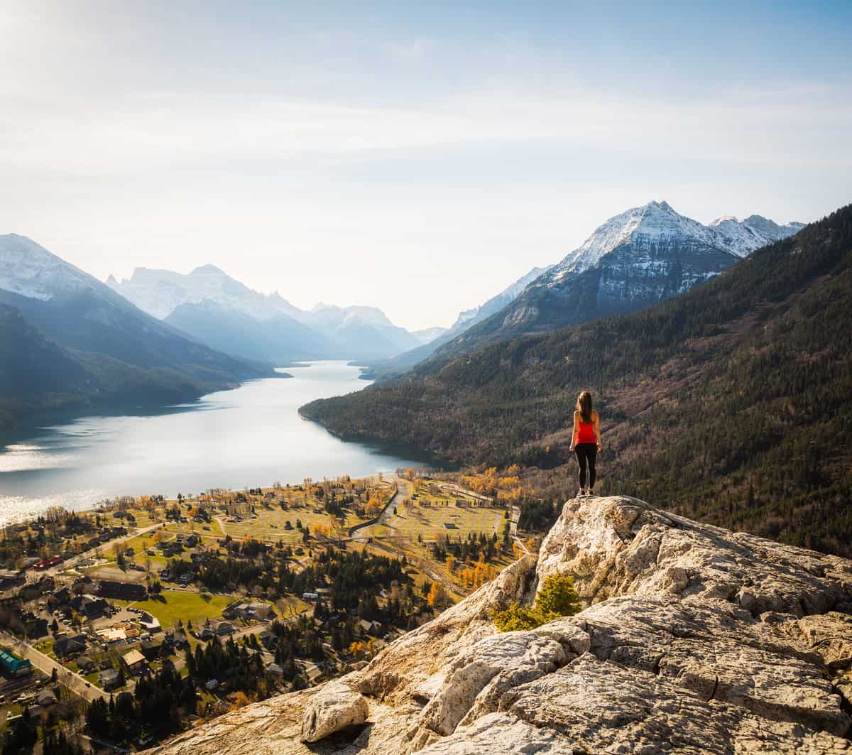
Bear’s Hump is a popular hike in summer; consider making the trek for sunrise or sunset to make it even more spectacular.
- Distance: 2.8 km
- Elevation gain: 225 m
- Difficulty: Moderate
- Estimated time to complete: 1 hour
- Trailhead location: Directly across from the Prince of Wales Hotel access road. If walking from the townsite, the trailhead is at the crest of the hill on your left.
- Be sure to bring: Water, and an extra layer of clothing for the top where it can be very windy.
Crescent Falls & Bighorn Canyon (David Thompson Country)
It’s possible to see the gorgeous Crescent Falls without a trek (you can drive right up to a viewing platform), but the easy walk along the top of Bighorn Canyon to get there is well worth it, especially for the wide view of the two-tiered falls that you can’t get otherwise. We’ve admittedly only done this trek during winter but rejoiced in having it all to ourselves; expect to encounter several more visitors in the warmer months.
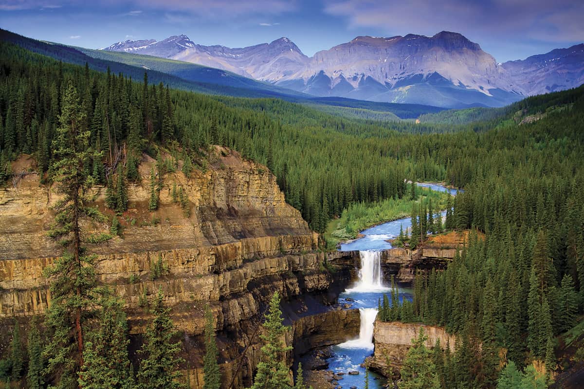
Some of this hike is a bit unremarkable as you’ll be shrouded in trees. There are also some blind corners – be sure to make noise as you go around them so you don’t startle any critters (as mentioned earlier, be sure to carry bear spray)!
- Distance: 4.9 km
- Elevation gain: 71 m
- Difficulty: Easy
- Estimated time to complete: 1 hour and 15 minutes
- Trailhead location: Access the trail from the Bighorn Canyon lookout. On the right side, you will see a path behind two large boulders blocking it and marked by a very faded sign.
- Be sure to bring: Water.
Skyline Trail (Jasper National Park)
It is Jasper National Park’s highest trail and is often cited as its most scenic. Because most of this phenomenal Alberta hike is above the treeline, sweeping views of the park are consistently available. As it crosses three mountain passes, much of the scenery is unique to this area.
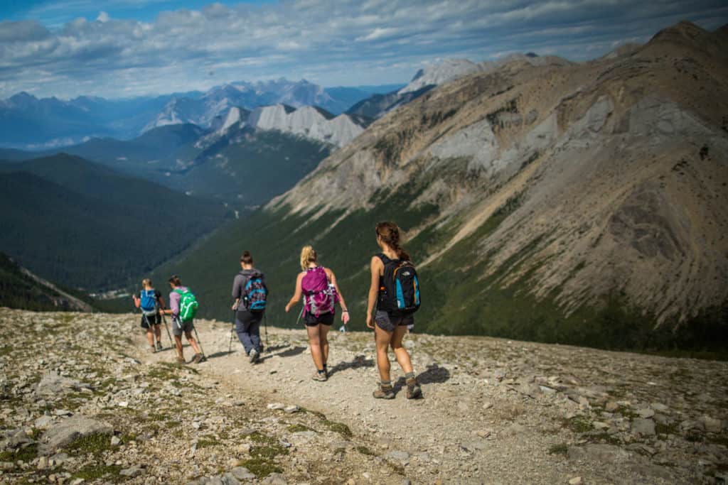
Expect a wide variety of flora and fauna as you trek this path for 2-3 days. Can’t get enough? Add another to relax and explore where you set up camp. Trail details with suggested itineraries and more can be found here.
- Distance: 44 km
- Elevation gain: 1,100 m
- Difficulty: Hard
- Estimated time to complete: 2-3 days
- Trailhead location: Past the chalet and across the bridge to the parking lot on the west side of Maligne Lake. The trailhead is on the right-hand side of the road, just before you reach the parking lot.
- Be sure to bring: Tenting equipment, other backcountry camping essentials, rain gear, warm clothing, food, water, hiking poles, and proper hiking boots. Note that fires are not permitted on this route.
Bow Glacier Falls (Banff National Park)
If you can’t tell from our trail selections, we are all about stuffing as much stunning scenery into one hike as possible, and Bow Glacier Falls is not to be missed for this reason. It’s a relatively gentle hike with little elevation gain, but the views offered are varied and gorgeous. Take in the clear blue Bow Lake, waterfalls, rock scrambles, and more. It is possible to walk right up and feel the spray of the falls at the far end of this most memorable of Alberta hikes.
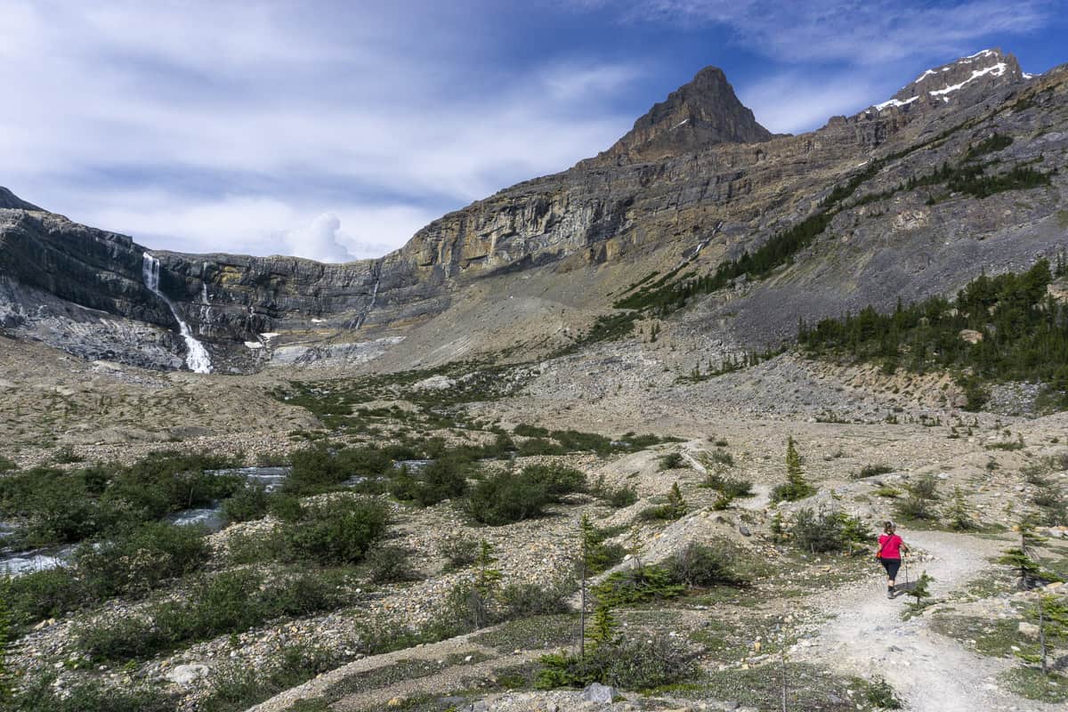
Given that this is a gentle hike, it is also a popular one in winter, and a great way to get your hiking legs ready in spring for bigger hikes to come in summer.
- Distance: 8.9 km
- Elevation gain: 155 m
- Difficulty: Moderate
- Estimated time to complete: 3 hours
- Trailhead location: Highway 93 North, 33 km north of the Lake Louise junction across from the Crowfoot Glacier Viewpoint, at the Num-Ti-Jah Lodge.
- Be sure to bring: Several layers of clothing, water, and snacks.
Matapiiksi (Hoodoo) Trail (Writing-on-Stone Provincial Park)
Writing-on-Stone Provincial Park, tucked away in southeastern Alberta, is a magical place not to be missed. It’s the newest UNESCO World Heritage Site in the province (added in 2019) and is known predominantly for its cultural and spiritual significance for the Blackfoot people.
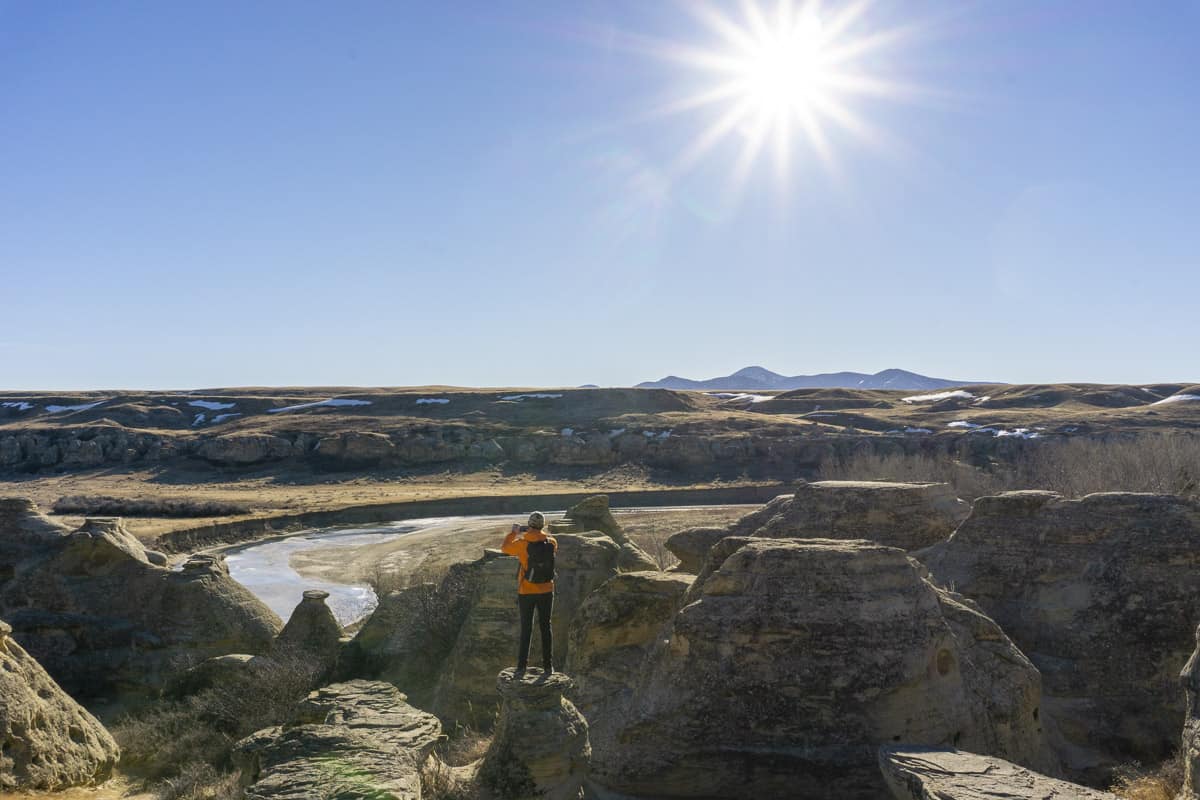
It’s also stunningly beautiful and unlike any other location you’ll visit in Alberta. There are a few hiking options in the park, but the Matapiiksi Trail is the longest and will showcase a variety of scenery. Keep your eyes peeled for rock art, the park has the largest collection on the North American Great Plains with over 50 clusters of petroglyph sites and thousands of works.
Note that rattlesnakes live here. For that reason, be sure to wear proper shoes (no flip flops!) and stick to the trails. While rattlesnakes are very unlikely to attack you, they may if startled or provoked.
- Distance: 5 km
- Elevation gain: 122 m
- Difficulty: Moderate
- Estimated time to complete: 1 hour and 40 minutes
- Trailhead location: Access the trail from the Writing-on-Stone Day Use area.
- Be sure to bring: Water, a hiking stick (to maintain your balance as you go up and down, but to also tap the ground to ensure any snakes leave the trail), a hat, and sunscreen.
Ha Ling Peak / Miner’s Path (near Canmore)
Ha Ling is probably the most well-known and popular hike in Canmore. It is ranked a difficult trail because of the elevation gain – it will really get the blood pumping! If you are ready for this challenge, do not forget to bring proper equipment (we recommend hiking poles), and dress in layers since the top can get very cold in summer and is prone to high winds.
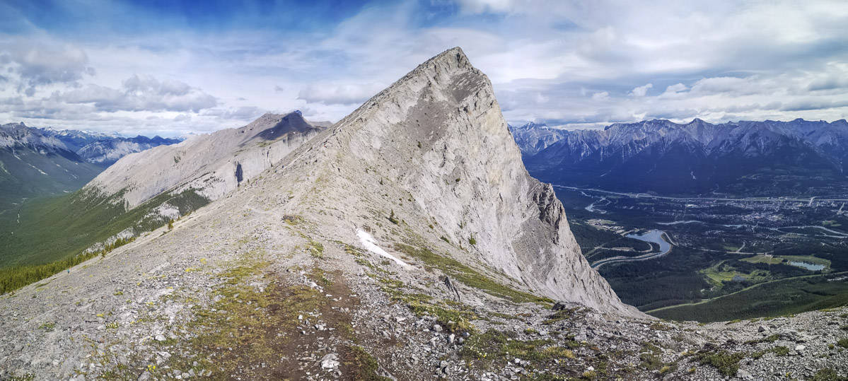
For this popular hike, many people endeavour to make it to the summit at sunrise, so you might actually have a quieter trail if you go later in the day. Alternatively, you can take the slightly easier alternative of Miners Peak. It is roughly the same distance and actually begins on the same trail as Ha Ling Peak – it even follows the same route until the saddle. At that point, instead of turning left to head up to Ha Ling Peak, turn right to summit Miners Peak instead. You will likely encounter fewer people (and no less fantastic views) if you do.
- Distance: 8.2 km
- Elevation gain: 864 m
- Difficulty: Hard
- Estimated time to complete: 4 hours
- Trailhead location: Park in the Goat Creek parking lot. From here, cross the road and climb up the embankment to the canal. Take the bridge across the canal, pass a stone marker, and enter the forest.
- Be sure to bring: Hiking poles, extra layers of clothing, a windbreaker jacket, snacks, and lots of water.
Mount Haig Lake (Castle Provincial Park)
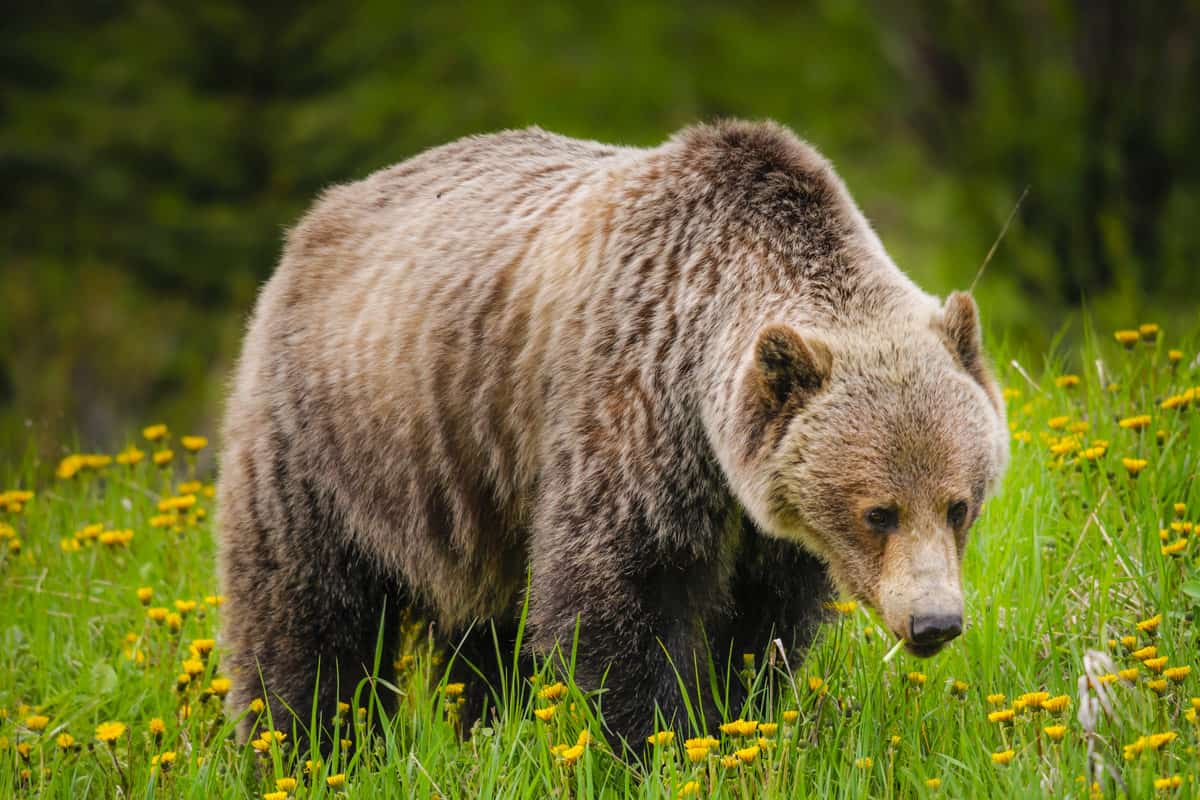
This trail will always hold a special memory for us as it was the spot of our first grizzly encounter! The bear didn’t care one iota about us or the other hikers nearby – it just wanted to cool off by swimming in the small lake while we sat around eating lunch.
We felt no danger to our safety, but with that being said, it’s important to be careful when hiking in prime grizzly country; be mindful of your surroundings, pack bear spray with you, and make noise on the trail so as not to startle any bears. On many Alberta hikes, there is the possibility of seeing bears – so always be prepared.
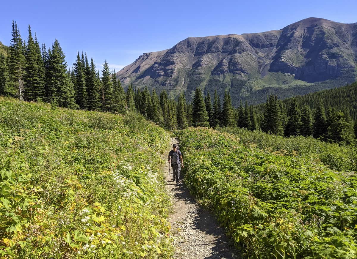
The grizzly bear we encountered ended up resting right by the south trail (we came up via the north and wanted to go back on the south). For safety’s sake, we returned the way we came leaving the bear to do as they pleased. We read later that our route was the reverse of what is recommended (the climb up the south is slightly easier), but we were not bothered in the slightest as the scenery was spectacular and kept us enthralled for its entire length.
Hikers who are feeling very ambitious can tack on the Mount Haig Peak hike. It adds a lot of elevation, but the views are supposedly incredible.
We were also there during berry season and found plenty of wild huckleberry and wildberry bushes along the way, which was a fun (and delicious) surprise. This is a lesser-known hike, so not terribly busy, and in our opinion, a must-do when in southern Alberta.
- Distance: 8.4 km
- Elevation gain: 466 m
- Difficulty: Moderate
- Estimated time to complete: 3 hours
- Trailhead location: The trail is well marked up the Castle ski hill and starts right beside the chair lift.
- Be sure to bring: Water and snacks (if you want more than just berries)!
Cirque Peak (Banff National Park)
An hour’s drive north of Banff, past Lake Louise up the Icefields Parkway, the Cirque Peak Trail features the beautiful Helen Lake on its route. The trek up to Helen Lake is tiring but not overwhelming. However, if you still have the energy, pushing up to Cirque Peak through the scree and scramble is worth it. (This is one of those epic Alberta hikes that you’ll talk about for years to come!)
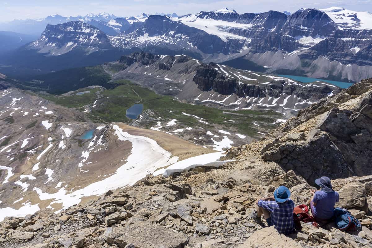
Be careful on the ascent and descent, as the scramble can be difficult, and may even require that you ditch your poles meters from the top to free up your hands for an all-points grand finale.
- Distance: 16 km
- Elevation gain: 1,135 m
- Difficulty: Hard
- Estimated time to complete: 7 hours
- Trailhead location: Across the Bow Lake is a parking lot designated for the Helen Lake hike, start the hike from the signed point in the parking lot.
- Be sure to bring: Hiking poles, gaiters, bear spray, snacks, several layers of clothing, lots of water, and plenty of snacks.
Tent Ridge (Kananaskis)
Think alpine meadows, narrow ridges, thick larch forests, and more. The Tent Ridge Horseshoe hike offers a variety of out-of-this-world views of K-Country (including the stunning Spray Lakes) and Banff National Park. It’s often touted as one of the best hikes in Alberta and the trail provides one of the most exciting adventures deep in the wilderness of the Canadian Rockies. This is one of the big Alberta hikes with big rewards.
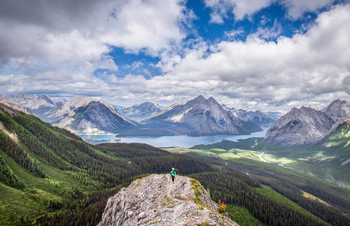
Go clockwise for an easier hike, or the reverse if you’re up for more of a challenge. If you do it more than once (many people do), maybe try it both ways! Because of the amount of scrambling involved, note that this hike is not recommended for children.
- Distance: 10 km
- Elevation gain: 828 m
- Difficulty: Hard
- Estimated time to complete: 4 hours, 20 minutes
- Trailhead location: The Tent Ridge trailhead can be found along Mount Shark Road, not far past the Mount Engadine Lodge.
- Be sure to bring: Hiking poles, several layers of clothes, windbreaker, snacks, water.
Blackshale Suspension Bridge (Kananaskis)
So this hike isn’t quite the most scenic or interesting of all the Alberta hikes, but if you are eager to get an epic photo “for the ‘gram,” then this hike provides a unique opportunity for one. It’s also a fairly quick walk that is easy enough for the whole family to enjoy!
If you want to shorten the hike and only see the bridge, it is possible to park closer and make a quick jaunt in to see it, but c’mon now, get some exercise!
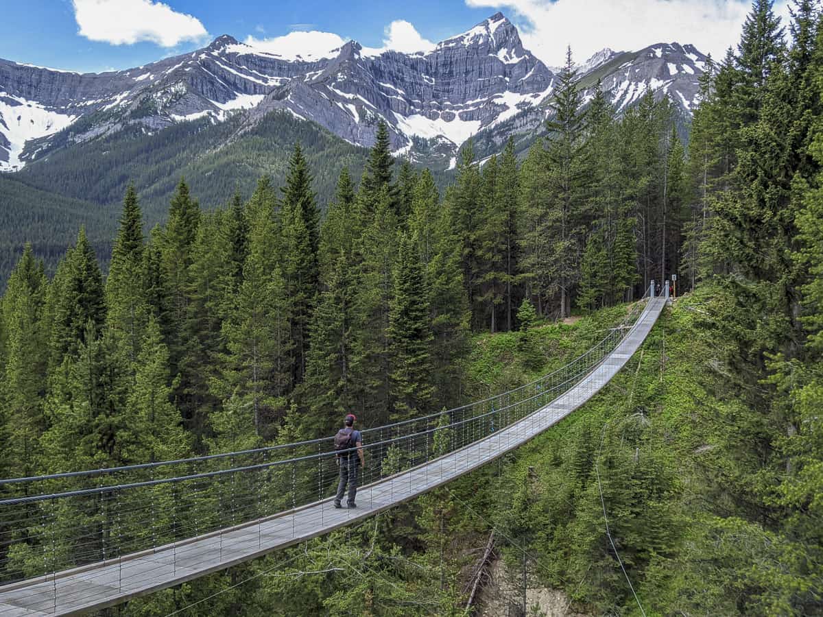
Once you get to the suspension bridge, take your shot from the northwest side in order to get a view of the bridge with a gorgeous slice of the Canadian Rockies in the background.
- Distance: 6.1 km
- Elevation gain: 333 m
- Difficulty: Easy
- Estimated time to complete: 2 hours, 15 minutes
- Trailhead location: The hike is accessible from the highway but is not clearly marked. The best way to access it is to park at the Black Prince Day Use Area then cross the highway, where the trailhead sits slightly off to the left.
- Be sure to bring: An extra layer of clothing as the weather can be quite variable when hiking in Kananaskis Country, snacks, water.
Want More Alberta Hikes?
We got ’em. Don’t miss our posts on the best hikes in Banff, hikes in Jasper, Canmore hikes and walks, and also our favourite Drumheller hikes.
As you wander around the province enjoying these great Alberta hikes, don’t forget to download our FREE Road Trip Alberta bingo cards to increase the fun during your car time!
Also don’t miss out on our picks for the most beautiful lakes in Alberta, and waterfalls in Alberta!

Dalene Heck is a co-founder of Road Trip Alberta. She was born in Edmonton, grew up in the Peace Country, and has ventured to almost every corner of Alberta and the world (she’s travelled to 60 countries)! She is a serial blogger, the CEO of HMI Marketing, co-creator of the Trip Chaser card game, a leukemia-slayer, and cat whisperer.
